Counselor
Sławomir Mikrut
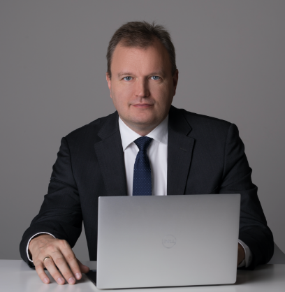
Dr hab. inż. Sławomir Mikrut, Professor AGH

He graduated from the Faculty of Mining Surveying and Environmental Engineering of AGH in the field of two specializations:
Engineering and Industrial Measurement and Photogrammetry and Remote Sensing.

In 2003, the Faculty Council WGGiIŚ awards the academic degree of “PhD in technical sciences” in the discipline of Geodesy and
Cartography. Doctoral dissertation: “The impact of scanning and compression according to the JPEG standard on the detection of
linear and point objects in digital images” - supervisor prof. dr hab. Eng. Józef Jachimski. In 2016 The Faculty Council of GGiIŚ
awards the degree of “habilitation” in discipline: Geodesy and Cartography, specialty: photogrammetry and remote sensing based
on the series of publications entitled “Automation of feature detection based on artificial intelligence methods for the construction of

photogrammetric measurement systems”.
Member of the Association of Polish Surveyors (SGP). Author or co-author of over 70 publications in the field of photogrammetry
and remote sensing (including 7 monographs).

Manager of 7 scientific and research projects (ministry of science, industry) and a dozen contractor.
In the years (2001-2003), the chief specialist in photogrammetry and Managing Director at Przedsiębiorstwo Fotolotniczy Geokart-
MGGP, since 2005 he has been the President of the Management Board in InvestGIS, EUROmetrex, carrying out geodesy and
cartography projects in Poland and abroad ( Australia, Germany, Romania).

In 2018 a co-founder of a startup company “HyperLab Solution”

OUR PARTNERS
Counselor
Sławomir Mikrut
Dr hab. inż. Sławomir Mikrut, Professor AGH

He graduated from the Faculty of Mining Surveying and Environmental Engineering of AGH in the field of two specializations:
Engineering and Industrial Measurement and Photogrammetry and Remote Sensing.

In 2003, the Faculty Council WGGiIŚ awards the academic degree of “PhD in technical sciences” in the discipline of Geodesy and
Cartography. Doctoral dissertation: “The impact of scanning and compression according to the JPEG standard on the detection of
linear and point objects in digital images” - supervisor prof. dr hab. Eng. Józef Jachimski. In 2016 The Faculty Council of GGiIŚ
awards the degree of “habilitation” in discipline: Geodesy and Cartography, specialty: photogrammetry and remote sensing based
on the series of publications entitled “Automation of feature detection based on artificial intelligence methods for the construction of

photogrammetric measurement systems”.
Member of the Association of Polish Surveyors (SGP). Author or co-author of over 70 publications in the field of photogrammetry
and remote sensing (including 7 monographs).

Manager of 7 scientific and research projects (ministry of science, industry) and a dozen contractor.
In the years (2001-2003), the chief specialist in photogrammetry and Managing Director at Przedsiębiorstwo Fotolotniczy Geokart-
MGGP, since 2005 he has been the President of the Management Board in InvestGIS, EUROmetrex, carrying out geodesy and
cartography projects in Poland and abroad ( Australia, Germany, Romania).

In 2018 a co-founder of a startup company “HyperLab Solution”

OUR PARTNERS
© 2021 www.polishisraeliforum.com
All rights reserved
Contact with us:
Forum Founder:

Mr. Marek Kobiec
54/56/20 H.Sienkiewicza Street
50349 Wroclaw,
Poland
mobile phone : +48 531 260 600
Forum Founder:

Mr. Chen Filipowicz
402 Nof Harim Street
9083600 Har Adar,  
Israel
mobile phone: +972 50 533 8688